It is worth remembering that clients can move once, or even multiple times during the selected reporting period and have multiple addresses attached to them. In such cases, client reports will show all locations (whether they are filtered through suburbs, postcodes or electoral boundaries, etc.) each client was served from.
Anna received her first service while living in the local government area of Willoughby City Council (Location A) in September 2017. She moved to Wollongong City Council (Location B) and received her second service in January 2018. The administrator of Pitt Street CLC ran the C03 report with all demographic filter as “Any,” for the period of 1 July 2017 – 30 June 2018. This report will add 1 to Location B in Wollongong City Council, and also to Location A, because Anna received services from both locations in that reporting period.
This is an isolated example to illustrate that C reports ran with an administrative boundary option will show all areas each client was living at the time of service delivery without adding to the total number of clients.
If a client was serviced in the past reporting period (i.e. financial year 2016-2017) and came back to receive another service in the current reporting period (i.e. financial year 2017-2018) under a new address, assuming this new address has been made a primary address, reports ran under the selected administrative boundary (i.e. local government area, as seen above) will list the area associated with the updated primary address at the time of latest service delivery.
Ibram had received a legal advice from Pitt Street CLC in April 2017. At this time, he lived at Location A in Willoughby City Council. He came back to receive another advice in August 2017, and by this time, he moved to Location B in Wollongong City Council. The administrator of Pitt Street CLC ran the C03 report with all demographic filter as “Any,” for the period of 1 July 2017 – 30 June 2018. This report will add 1 to Location B in Wollongong City Council, but not to Location A, because the address Ibram had back in April 2017 is outside the financial year of 2017-2018.
If a client’s address changes before an ongoing service (i.e. Representation or Court/Tribunal services) is closed — in other words, if this client had one address at the opening of the service and a different address at the closing of this service — then the report will always list the area associated with the address geotagged at the start of the service.
Lauren came to Pitt Street CLC in October 2017 and was deemed eligible to receive a representation service on an ongoing capacity. She was living at Location A in Willoughby City Council when her case was opened in October. Her case was closed in December 2017, and by this time she was living at Location B in Wollongong City Council. The administrator of Pitt Street CLC ran the C03 report with all demographic filter as “Any,” for the period of 1 July 2017 – 30 June 2018. This report will add 1 to Location A in Willoughby City Council because that was the address geotagged at the opening of an ongoing service.
In an ideal world, every client should have a complete and accurate address — but in reality, it is inevitable that some data will end up missing either as a result of human error or inaccurate information delivered during data entry process. Furthermore, it is also possible that some clients visiting CLCs do not have a fixed address.
The geolocation system estimates administrative boundaries for incomplete addresses to the best of its ability, for the end of minimising “unknown” results.
This table shows how different combinations of address elements estimate administrative boundaries.
Street Number | Street Name | Street Type | Suburb | Postcode | State | MAINCODE | Type | Method |
X | X | X | X | X | X | Mesh Block | Exact | Exact Match |
X | X | X | X | Mesh Block | Exact | Exact Match | ||
X | X | X | X | X | Mesh Block | Exact | Exact Match | |
X | X | X | X | X | LGA | Estimate | Highest Count LGA for Street AND Street Type AND Postcode | |
X | X | X | LGA | Estimate | Highest Count LGA for Street AND Street Type AND Postcode | |||
X | X | X | X | LGA | Estimate | Highest Count LGA for Street AND Street Type AND SUBURB AND STATE | ||
X | X | X | X | X | SA1 | Estimate | Highest Count SA1 for Street AND Street Type AND Postcode | |
X | X | X | SA1 | Estimate | Highest Count SA1 for Street AND Street Type AND Postcode | |||
X | X | X | X | SA1 | Estimate | Highest Count SA1 for Street AND Street Type AND SUBURB AND STATE | ||
X | X | X | X | SA1/SA2 | Estimate | If Street name is unique for Postcode SA1 Otherwise Highest count SA2 for Postcode. | ||
X | X | X | SA1/SA2 | Estimate | If Street name is unique for Suburb AND state SA1 Otherwise highest count SA2 for Suburb AND state. | |||
X | X | SA1/SA2 | Estimate | If Street Name is unique for Postcode SA1 Otherwise Highest count SA2 for Postcode, | ||||
X | SA2 | Estimate | highest count SA2 for postcode | |||||
X | X | SA2 | Estimate | highest count SA2 for Suburb AND state | ||||
X | X | X | SA2 | Estimate | highest count SA2 for postcode |
When performing a query on an incomplete address, depending on the level of data supplied, the system will perform a count on the highest occurring administrative boundaries to approximate the data.
The following is an example of an address that did not include the street number:
| Botany Road Mascot NSW |
From this address we will get 1165 number of records where the address matches the criteria.
In order to assign a SA1 code we will get the highest count of the SA1 code (11701132205) for this search result, which is the best estimate.
The reasoning behind this is that at the ‘suburb/postcode’ level, the SA2 code will generally correspond strongly to a single SA2 code.
The combination of ‘street + street type + postcode/suburb’ is the minimum criteria of data that allows the determination of a rough estimate of SA1 code.
Ensuring to update the address before adding a new service is important because geotagging attaches to services, not clients. CLASS users are encouraged to update primary address before starting service as this will result in the most accurate data. Intake Process will support this implementation as any new address entered during the intake will be saved to the client prior to the service. When performing an intake for an existing client the user has the option to update the primary address as part of the workflow.
Alternatively, you can update client address from “Additional Details” tab from a client file.
Click on “New” from “Additional Address” section.

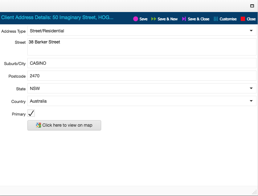
Enter in the new address and check “Primary.” Save & Close. This will update the address in the main client page.

The logic of geotagging, put simply, is that the address entered before the creation of a service will be tagged onto this service. This in turn means that an address modified after the creation of a service will not re-tag the associated service. For this reason, until a change to this logic is made, the address entered prior to the creation of a service must be accurate for the system to determine correct administrative boundaries. This is best exemplified via DIY reports.
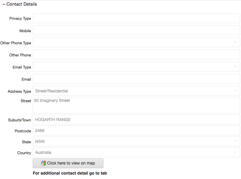
A made-up address that does not exist has been entered into the Client page before the service is added. A single typo, such as Athol Street being entered as Athal Street will have the same effect.
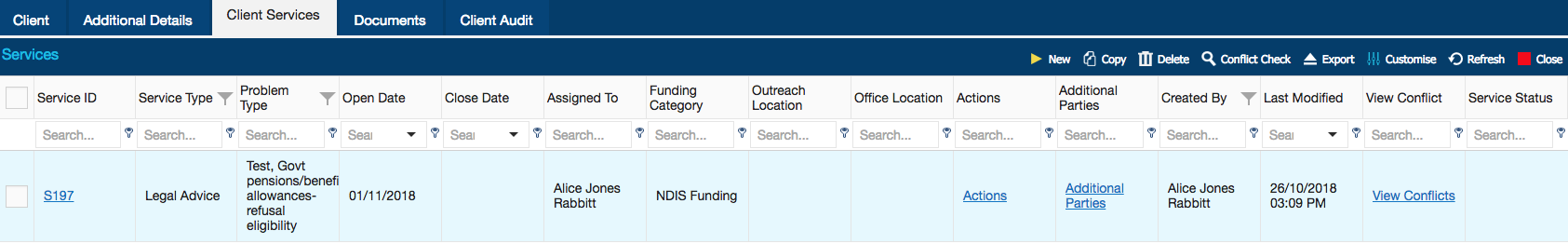
A Service has been created after entering the above address.
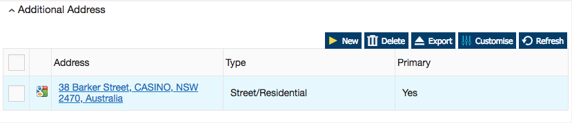
Then, from the Additional Details page, the existing (fake) address was clicked on for the purpose of correction to a valid address.

A new and valid address is added, then saved.
After following the steps above, DIY report was loaded to demonstrate the effect.
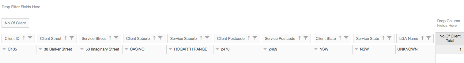
In DIY reports, users have an option to select between two different classes of addresses: Client Address and Service Address. For demonstration’s sake, Client Address and Service Address elements were juxtaposed to each other in this report.
One can observe:
The initially entered, fake address, 50 Imaginary Street, Hogarth Range NSW 2469 has been tagged as the Service Address. This is the direct result of the geotagging logic – that address entered before service creation is the one tagged on the service.
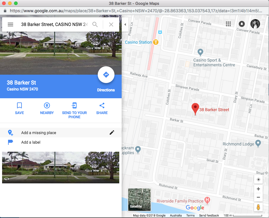
On the other hand, the subsequently entered, valid address, 38 Barker Street, Casino NSW 2470 is classified as the Client Address. This is because this is the updated address showing on the main client page.
LGA Name is Unknown, because geolocation logic follows addresses attached to services, and here, the Service address is invalid. Therefore, having a correct and valid address before entering service details is very important for geolocation reporting.